Romania Photo of the Day by Dreamstime: Vinderel Lake
The Romania Photo of the Day created in partnership with stock photo provider Dreamstime aims to highlight the best of Romania. From stunning landscapes and popular tourist destinations and landmarks to people, traditions, and food, this series helps you discover Romania one photo at a time. This week, we put the focus on Romanian mountain lakes.
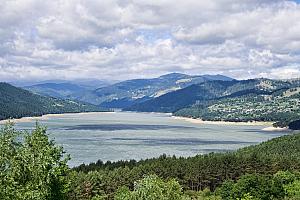
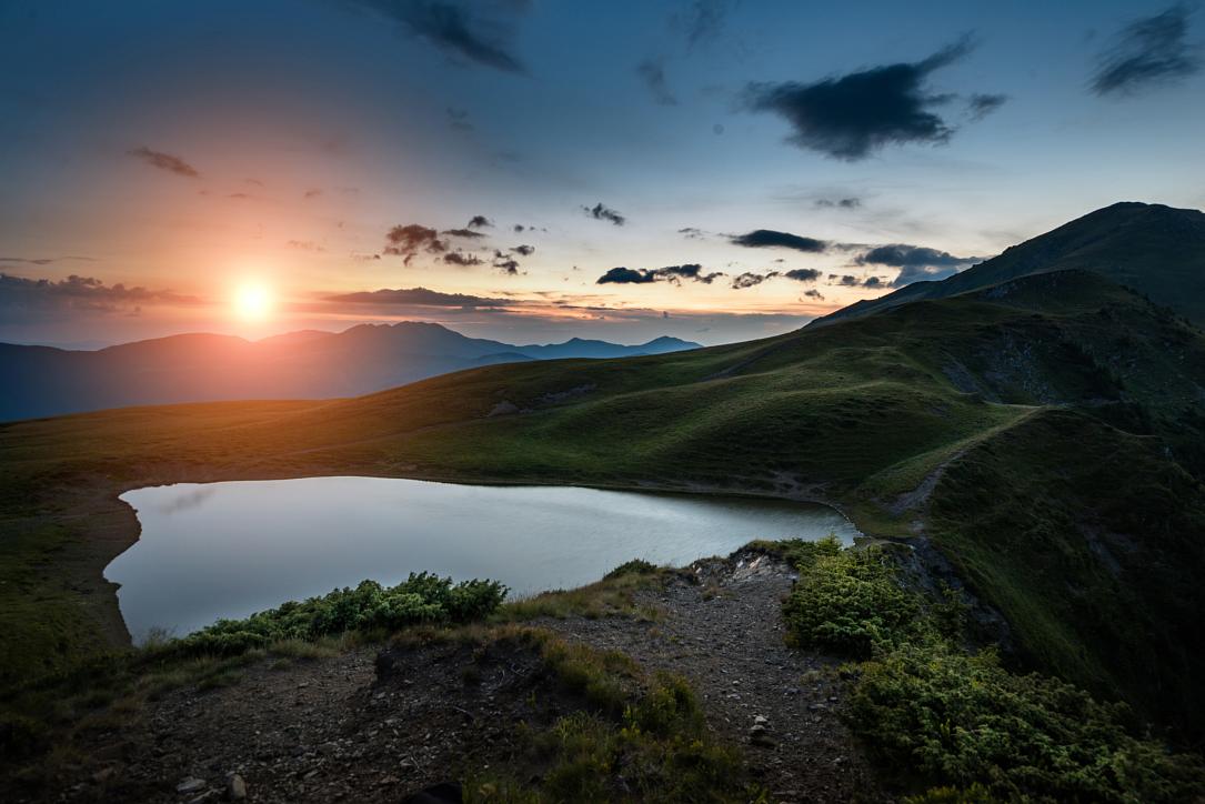
The small glacial Lake Vinderel is located on the ridge connecting Farcău Peak and Mihăilecu Peak, at an altitude of 1615m on the territory of Repedea and Poienile de Sub Munte, in the Maramureș Mountains. (Photo source - click on the number to get to the photo 172655297 © Volodymyr Martyniuk | Dreamstime.com)
The geological, faunal, and landscape reserve covers an area of 150 hectares, which is part of the Maramureș Mountains Natural Park, and aims to preserve the local biological diversity, says infopensiuni.ro. The reserve includes the Farcău and Mihăilecu peaks, Julii Cave, Bologhii Cave, Wolves’ Cave, and Vinderel Lake.
The lake is fed by snowmelt and rainwater, and by the small basins of swamp-like water located on its southern shore. The banks are grassy and slope gently down to the lake, says Bogatiile Muntilor Maramures, with some juniper thickets to the east. Other species of plants found on the edge of the lake are Edelweiss, Peat Mosses, Cottongrass, and Hawkweed.
Vinderel Lake has given rise to many legends, some of which describe it as a bottomless lake, others saying it is inhabited by a dragon that feeds on whoever might enter its water. One such tale, told by Stirileprotv.ro, says the dragon once ate all the guests at a wedding that was held by the lake’s side. It is also said that it is not good to throw a stone into this lake because you will start a storm.
Maramureș Mountains Natural Park's website tells us of two different hiking trails that can be followed, if you want to visit Vinderel Lake:
- Repedea - Chicerea – Vinderel Lake
Trail marking: Blue stripe
Trail length: 10 km
Trail duration: 4-5 hours
Difficulty: medium, difficult in winter.
From the center of Repedea the marker follows the lane leading to the school. From the corner of the school, the marked path changes direction to the east, winding its way up through the small farms in the Poposală area. Enter the forest, leaving the ridge and Chicera Peak to the left. One then reaches the stable in Laba. From here the path climbs steeply, passing the Runea hut and leaving the Rugașul ridge on the right. Then you reach an area from where you can see the Farcău massif. The trail continues, crossing several torrential streams, and after approximately 1 hour, you reach Vinderel Lake.
- Repedea - Pietriceaua – Vinderel Lake
Trail marking: Blue stripe
Trail length: 12 km
Trail duration: 4-5 hours
Difficulty: medium, winter difficult.
From the center of the village, the marker follows the road along the Repedea valley, and after approx. 4 km you reach the Repedea Forest Canton. Continue on the road until the confluence with the Tomnatecu valley. From here you cross the Repedea valley, going up to the mountain hollow below Pietriceaua. You keep going north until you reach the lake.